
Avenida Apartments Benidorm 2 Star
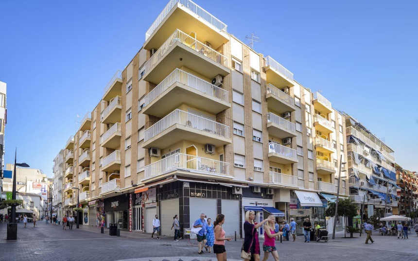
Description of Avenida Apartments Benidorm
Click Photo for larger Image
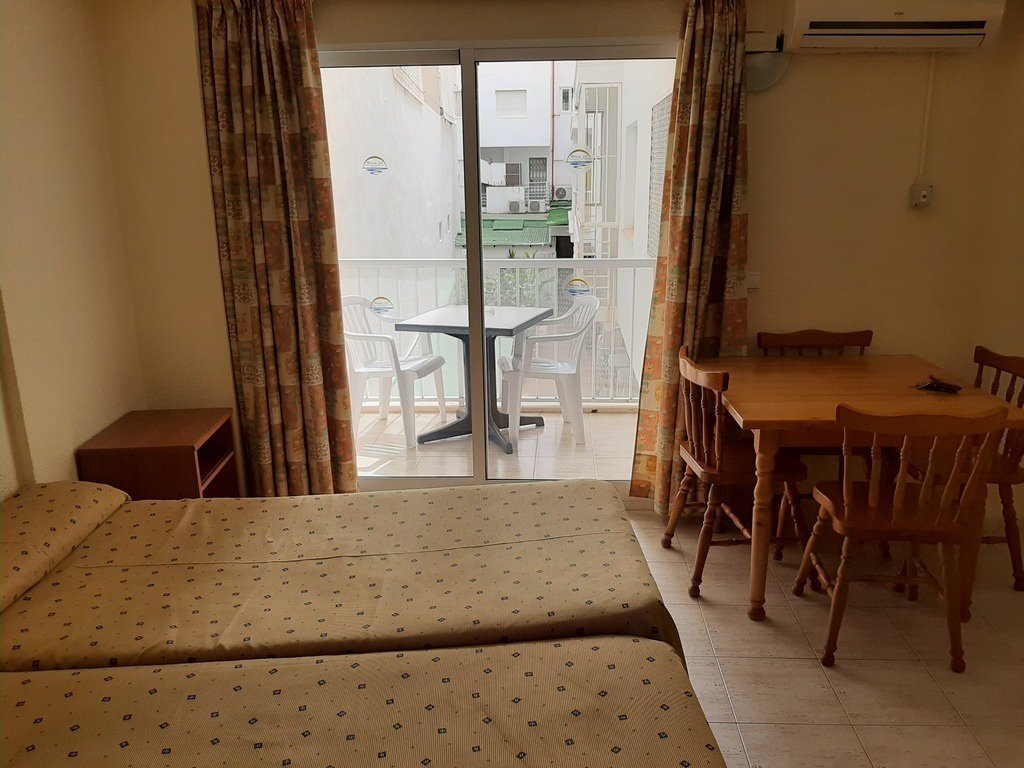
Avenida Apartments Benidorm Studio Room & Balcony
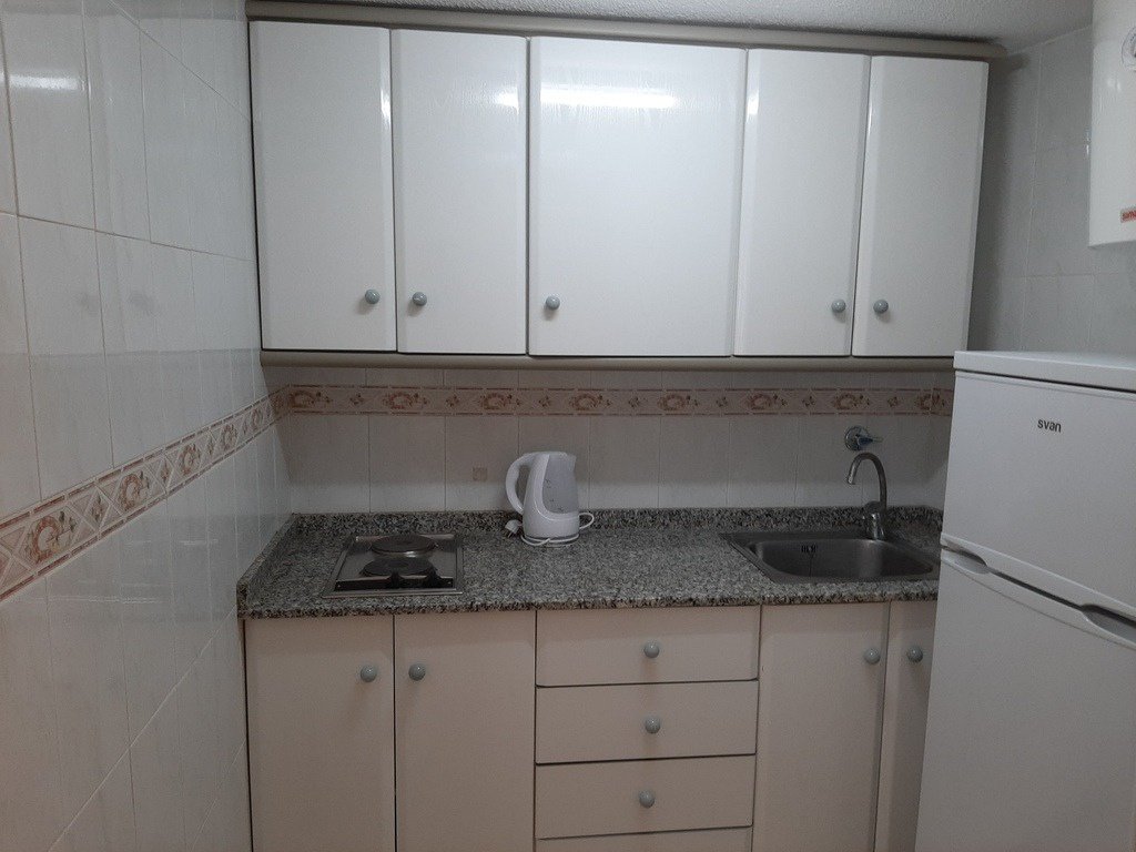
Avenida Apartments Benidorm Studio-Kitchenette
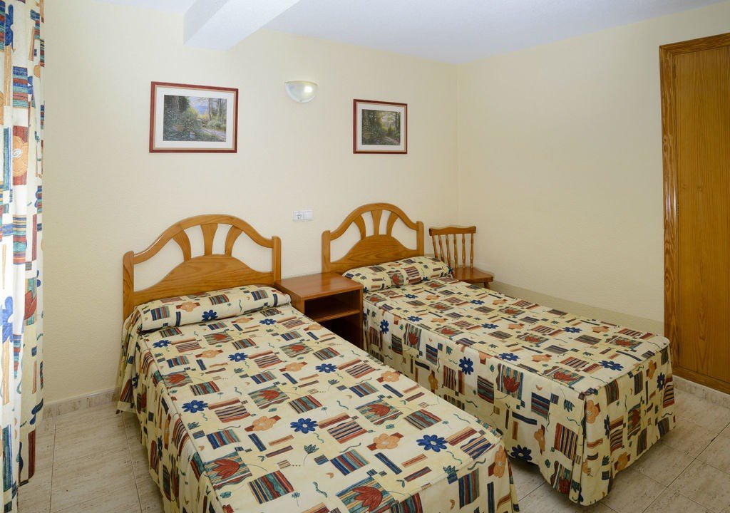
Avenida Apartments Benidorm Bedroom
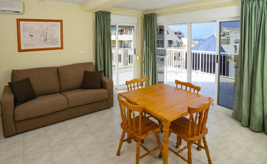
Avenida Apartments Benidorm
- Although only 2 star apartment the 4 star facilities of the Avenida Hotel just accross the pedestrian road are available. These include:
- Roof Top Swimming Pool , & Sun Terrace with Sunbeds.
- Bar & Lounge
- Restaurant with dress code.
- 24 hour Reception
- Luggage Storage
- Self service laundry
- 1 and 2-bedroom apartments and studios
More Information or Book Accomodation, flights & transfers with Sunshine Holidays

Location of Avenida Apartments Benidorm
- Centrally located on the border of the 2 most popular areas of Benidorm, The Old Town & Levante. giving you easy access to the nightlife of both these areas.
- Levante Beach only 150m walk.
- Triangular Square only 160m walk
- Kafee Klee a popular drag show bar 70m walk fromWalking Street
- Address: Avenida Apartments, C. Gambo, 1, 03503 Benidorm, Alicante, Spain.
- See location Avenida Apartments Benidorm on our Gay Bars & Clubs Map
Apartments Types
All apartment types have towels & bed linen
Studios
- Studio for one or two people
- 2 single beds
- Kitchenette
- Private bathroom
- Balcony overlooking the inner courtyard
One Bedroom Apartment
- Large 45 m2; apartments
- 1 Bedroom 2 single beds plus 1 double sofa bed in the living room
- Ktchen
- Bathroom
- Balcony
Two Bedroom Apartment
- Large 55 m2; apartments
- 2 bedrooms, each with two single beds PLUS Lving room with a double sofa bed
- Kitchen,
- Bathroom
- Balcony
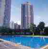
Flamingo Beach Resort Benidorm 4 Star  Rincon de Loix Levante beach 800m
Adults Only over 14. No Stag or Hen Groups
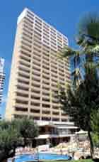
Flamingo Beach Resort Benidorm
Location of Flamingo Beach Resort Benidorm
- 700m to the edge of New Benidorm
- 800m from the sea
- 200m to shops, bars and restaurants Local bars and clubs can be noisy, especially in July and August
![]()
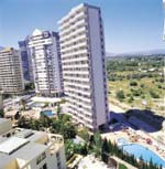
Now Benidorm Apartments 3 Star Rincon de Loix
Click Photo for larger Image
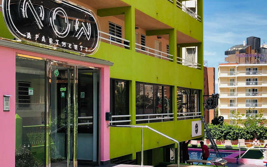
Now Benidorm Apartments Entrance
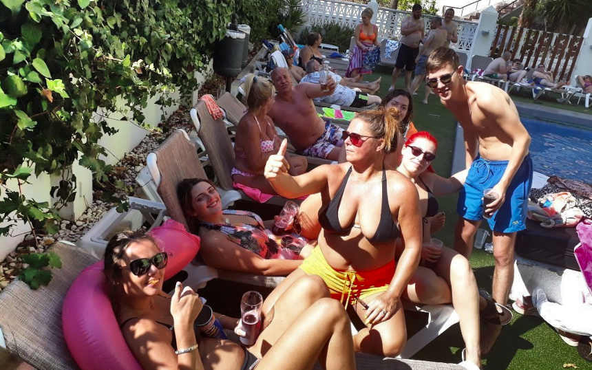
Now Benidorm Apartments Poolside & Great for Stag Parties, Hen Parties & Fun lovers
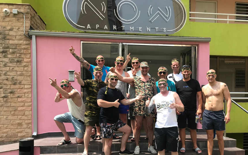
Now Benidorm Apartments Stag Party at the Entrance
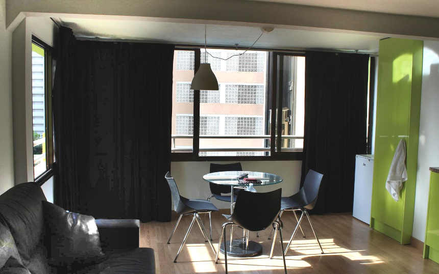
Now Benidorm Apartments, Apartment Lounge
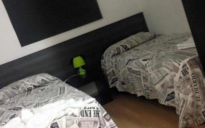
Now Benidorm Apartments, Apartment Bedroom
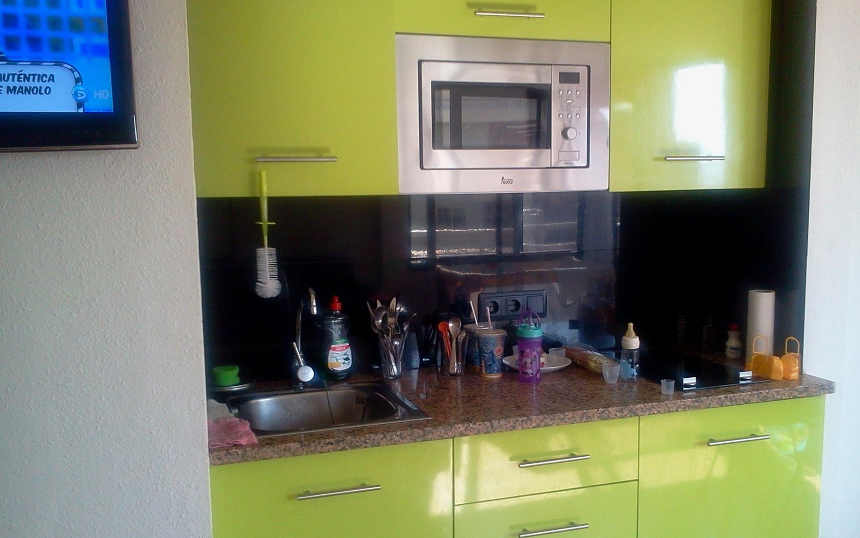
Now Benidorm Apartments, Apartment Kitchenette
Description of Now Benidorm Apartments
- The Party & Fun Apartments
- Perfect for Stag & Hen Parties
- Free Wifi
- Sea views
- TV with USB input
- Gym
- Bar
- Pool
- Change of sheets and towels
- Free cleaning service (+3 nights)
- Air conditioning / Heating
- Safe-deposit box
- 24 hour reception (weekends)
- Kitchen and Fridge
- Microwave oven
- Complete bathroom
- Hair dryer and Iron
- Wardrobe
- Proximity (5 minutes) to bars and beach
- Water boiler
Location of Now Benidorm Apartments
- Rincon de Loix area of Benidorm
- English Square. A Main Nightlife area.
- Levante Beach 450m
- Address: Now Benidorm Apartments, C. Bruselas, 6, 03503 Benidorm, Alicante, Spain
- See location Now Benidorm Apartments on our Benidorm Apartment & Hotel Map
More Information or Book Accomodation, flights & transfers with Sunshine Holidays
Paraiso 10 apartments Benidorm 3 Star 
Paraiso 10 apartments, Benidorm, Costa Blanca, Spain
The Paraiso 10 Apartments are light, airy and modern. Relax by the pool or head for Levante Beach, just 800 metres away.
These apartments suit everyone especially families with children
![]()
Primavera Loix Apartments Benidorm 3 Star
Primavera Loix Apartments Benidorm 3 Star
Primavera Loix Apartments
Description of Primavera Loix Apartments
- Primavera Loix Apartments are in a quieter area of Benidorm, yet still quite centrally located.
- These apartments afford views across the resort and are close to all the local amenities including the large Benidorm. market, Levante Beach shops, restaurants and bars .
More Information or Book Accomodation, flights & transfers with Sunshine
Location ofPrimavera Loix Apartments
- Centrally located in the resort yet in a quiet area
- Calle Gerona, one on the main nightlife streets, 370m
- Levante Beach, 500m
- Bus Stop Av. Europa 21, 540m
Vacanza apartment Complex Benidorm 3 Star
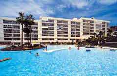
Vacanza apartment Complex Benidorm
Description of The Vacanza apartment Complex Benidorm
- The Vacanza is complex of six apartment blocks of bright, modern apartmentsis set in attractive grounds
- Massive tropical style pool area surrounded by palm trees. The largest swimming pool in Benidorm
- Kids pool (supervise by lifeguard).
- Spa/fitness area: Sauna, Jacuzzi, Gym, squash & tennis courts.
- One bedroom apartments for up to 6 people
- Two bedroom apartments for up to 8 people
Location of The Vacanza apartment Complex Benidorm
- Located on a Hilltop position in Rincon de Loix district of Benidorm.
- Levante Beach 600m.
- 5 minutes walk from the main british area of bars and restaurants.
- Between 5 to 15 minutes walk from main night clubs area (The Square).
- Supermarket 80m. Snack bar
- Nearest Bar 400m, Snack Bar 280m
- Address: C. de Londres, 16, 03503 Benidorm, Alicante, Spain
![]()
Vista Mar apartments Benidorm 2 Star
The Vista Mar hotel is a popular simple apartment complex with a large swimming pool sun terrace and garden
More Information or Book Accomodation, flights & transfers with Sunshine Holidays

Location
The Vista Mar hotel is located 700 metres from Levante beach and the resort centre and slightly nearer to bars and restaurants. A mini supermarket is located next door.
Terralta Apartments Benidorm 3 Star
Fabulous swimming pool
More Information or Book Accomodation, flights & transfers with Sunshine Holidays
Location
- 1km to Poniente beach
- 1.5km to resort centre with shops, bars and restaurants
- Bus stop outside apartments